Tuesday, July 31, 2012

Hynish

At the end of the B8066 at the south west end of Tiree, you come across a group of early-Victorian buildings with an incongruously instutional look about them in the surrounding Hebridean crofting landscape:-

Looking like a cross between a prison camp and a work house, if this was in the Channel Islands, you could imagine they held some dark secret of the Nazi occupation but this is, in fact, Hynish, the shore base for the construction of the Skerryvore Lighthouse.

Built between 1838 and 1844 under the supervision of engineer Alan Stevenson (uncle of the author of Treasure Island, Robert Louis Stevenson), Skerryvore is built of granite quarried on Mull which was brought to Hynish to be shaped into blocks before being shipped out to the reef 10 miles (16km) south west of Tiree and incorporated into the rising structure of the lighthouse.

Hynish and Skerryvore on the Scotland - West Coast admiralty chart

Skerryvore Lighthouse - photo credit Ian Cowe

I first learnt about Hynish in 1994 when I visited Tiree on holiday. The signal tower which communicated by semaphore with the workers on the rock is a museum about the construction of the lighthouse while the keepers' houses are now affordable homes for Tiree residents. The remainder of the buildings form the Hynish Centre run by the Hebridean Trust for holding conferences and courses etc.

Hynish Wet Dock - picture credit Clyde Cruising Club
But what I didn't know about Hynish until the other day is that the harbour there (pictured above) was a wet dock. I've seen it referred to as a dry dock but it was exactly the opposite - a wet dock - because it could be kept full of water when the tide was out by closing lock gates (which have since disappeared) across the mouth of the dock. You can see the grooves the gates were located in in the photo below.

Hynish by Niall Corbet
The point of it being a wet dock was that it was much easier to load boats with the heavy granite blocks for the lighthouse if they could be kept afloat at a constant level next to the pier rather than going up and down with the tide and drying out at low water.

Even more interesting is that the wet dock at Hynish didn't rely on a high tide to be filled up but was equipped with an onshore reservoir of fresh water to fill it. You can see the whole arrangement  clearly on the OS 25 inch map of 1878 when the wet dock was apparently still in operation:-

What always strikes me about these things is that Victorian engineers like Stevenson - with no GPS or internet or software and presumably just pencil and paper - had to think about stuff like the shore base as well as the lighthouse on the rock. The wet dock would have been quite an achievement on its own!

The reservoir with its associated dam and sluice are also still clearly visible on Google Earth:-


You can see them quite clearly on the ground as well:-


The point of this post is I think it's fascinating to discover examples of such quintessential Victorian engineering as a wet dock (albeit on a small scale) in such a remote location as Tiree. And in such a state of preservation. Also, how it's possible to go for a virtual look round the past and the present without leaving my seat here in the Azores courtesy of such resources as Google Earth and National Libraries of Scotland Maps. But if you are actually going to Tiree any time soon, do go up on that dam and take a few photos and add them to Canmore.

Extract from OS 1 inch sheet 44 Coll & Tiree

Sunday, July 29, 2012

Another trawl through Flickr: The Outer Isles Mail

I've uncovered another absolute cracker of a photo in the course of another of my periodic sessions on Flickr


 That picture by Sandy Stevenson shows a car being craned off MacBrayne's MV Lochmor (1930) at Tarbert, Harris. It's interesting to contrast it with vehicles coming off a Calmac ship at a Hebridean port in the 21st century:-

MV Clansman at Castlebay by Michael McIntyre
I uploaded a picture to my own Flickr photostream the other night of a scan of a 1955 MacBrayne's brochure. What caught my eye was that it said - almost as an afterthought - "MOTOR CARS. These can be conveyed by prior arrangement on most steamer routes." How times have changed!

  
Going back to the picture of the Lochmor at Tarbert at the top, there's a detail in it that allows the photo to be dated quite closely. Note how the hull of the ship (the bit round the three round portholes at bottom left) is grey rather than the usual MacBrayne's black. That tells us the photo was taken in 1930 or 1931 when the Lochmor was brand new.

The reason is that the 1920s had seen MacBrayne's in financial difficulties culminating in their withdrawing their tender for the vital mail contract to the Western Isles in 1928. As nobody else had tendered either, that would be the equivalent today of nobody - not even Calmac - bidding for the subsidy to run the car ferry services to the islands. The government therefore brokered a solution whereby MacBrayne's was taken over from the MacBrayne family by a consortium between Coast Lines (a shipping company specialising in trade around the Irish Sea; it was eventually taken over by P&O in the early 70s) and the London Midland & Scottish Railway. This new management attempted a rebranding exercise (as we would call it today) of re-painting the fleet's hulls light grey but it didn't catch on and they reverted to the traditional black in 1931.

A grey hulled Lochmor at Kyle of Lochalsh in the early 30s
The Lochmor also called at Lochmaddy but sailed from Mallaig and Kyle of Lochalsh rather than Uig on a 24 hour circuit round Skye (clockwise and anti-clockwise on alternate days) known as "the Outer Isles Mail". It also included calls at Scalpay, Stockinish (Harris), Rodel (these last two being ferry calls), Lochboisdale, Canna, Rum and Eigg.

The Outer Isles Mail timetable in 1934 (click to enlarge)


The route of the Outer Isles Mail service

The Lochmor with traditional black hull at Lochmaddy

The Outer Isles Mail service ceased in 1964 when it was replaced by the new car ferry service running from Uig to just Tarbert and Lochmaddy. Scalpay and the Small Isles (Eigg, Rum & Canna) got their own dedicated services. The Lochmor was sold for further service in the Aegean. Her replacement on the new "Uig Triangle" service was the Hebrides (II) which served the route until 1985 and, as we're in a "then and now" mood, I'll finish with a picture of her followed by one of the current ferry to Tarbert and Lochmaddy, the Hebrides (III) both in the same position canting (turning) to approach the pier at Uig.

MV Hebrides (II) (1964) approaching Uig pier

MV Hebrides (III) (2001) at Uig - picture credit Alpha Deux Cents

Sunday, July 1, 2012

Stornoway ferry

As mentioned before, I periodically go to Flickr and enter search terms such as "Mallaig", "Kyle of Lochalsh" and "MacBrayne" in the hope of uncovering some transport gem. The other day, I was rewarded with a couple of absolute crackers which between them tell a little bit of transport history in the Kyles and Western Isles.


That picture by Robert Chappell shows a car being hoisted off MacBrayne's MV Loch Seaforth. From 1947 to 1972, she was the ferry (as we would say nowadays; at the time they would have said "steamer" even though the Loch Seaforth wasn't a steamship) which served Stornoway, sailing daily from the railheads of Mallaig and Kyle of Lochalsh. Her sailings were designed around passengers joining her off trains from Glasgow and Inverness. Passengers driving from Glasgow to Lewis (a tiny minority in the 1950s) had to have their cars craned on and off as seen above. (Robert's picture is actually taken at Armadale on Skye: between her Stornoway sailings in the late 50s, the Loch Seaforth crossed from Mallaig for the conveyance of cars as an alternative to the car ferries to Skye at Kyle of Lochalsh. Exactly as today's Mallaig-Armadale ferry continues to provide an alternative to the bridge to Skye at Kyle.)


The second picture I found shows the next development - the first car ferry on the Stornoway run. George Woods' picture above shows the Loch Seaforth's successor from May 1972, the MV Iona, at Kyle of Lochalsh.

What makes George's picture so interesting is that the Iona sailing from Mallaig and Kyle was just a short term stopgap measure. The long term plan was to move the Stornoway sailings to Ullapool and this duly commenced in March 1973. It was one of the outermost ripples of the move from rail to road based transport which swept through Britain in the 1960s. There's no railway to Ullapool but it's much the most convenient port to Stornoway for the motorist.

To bring this story down to date, a contract has just been placed for the latest ferry to operate the Ullapool-Stornoway route:-

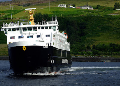
 An ugly looking brute (although I remember saying exactly the same when I saw the Iona for the first time in the 1970s). More details about the new Stornoway ferry on CMAL's website. It is not uncontroversial. As I understand it, much the better option to replace the aging (1995) existing vessel would have been to commission two smaller ships to shuttle back and forward giving greater frequency of service. But "two small" is more expensive than "one big" (particularly paying two crews) so considerations of affordability have prevailed over the preferred option.

I've digressed a bit from the original subject of discoveries on Flickr so to get us back on topic, I'll finish with another beauty from that source:-

The Loch Seaforth at Kyle by Colin Duncan